Geothermal prospecting and feasibility studies are important steps in developing a
geothermal energy project. Geothermal prospecting involves various scientific disciplines and methods
starting from the stages of exploration, drilling, well testing, and resource assessment to identify
and characterize geothermal potential in an area by building a conceptual model. The information
obtained from the study is summarized in a geothermal feasibility study needed to determine whether
or not a geothermal energy project is feasible to be developed.
The exploration phase includes geological, geochemical, and geophysical surveys, also known as 3G.
This survey aims to map the features above the surface and below the surface of the geothermal
system, such as hot springs, hot mud, hot steam (fumaroles and solfatara), and hot/warm ground.
These surface manifestations are a consequence of the existence of a heat source below the earth's
surface which heats the fluid in the reservoir and exits to the surface through the weak zone of
overburden.
Geology
A geological study aims to identify features and geological structures that control the presence
and distribution of geothermal fluids in an area. This includes mapping the surface geology and
identifying faults, fractures, volcanic features, hydrothermal alteration zones, or other
geothermal manifestations. Geological studies also involve collecting rock samples for
laboratory analysis to determine their mineralogy, petrology, geochemistry, and geochronology
(age dating). The results of geological studies can provide information about the origin,
evolution, and characteristics of geothermal systems, as well as their potential size,
productivity, and sustainability.
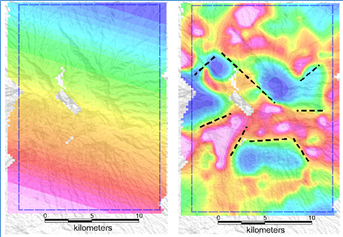
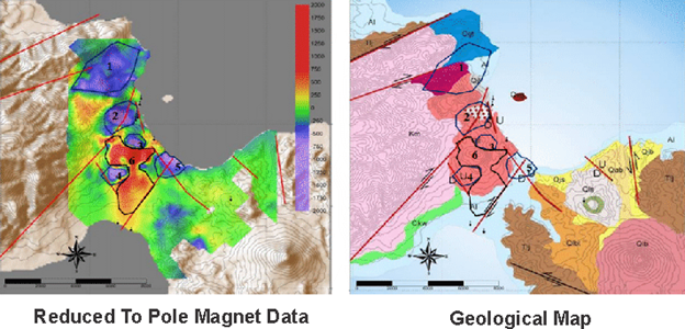
Geophysics
Geophysics studies aim to measure the physical properties of the subsurface that reflect the
presence and distribution of geothermal fluids by using tools that work with physics principles.
The methods commonly used in geothermal exploration are
gravity,
magnetic,
geoelectric,
electromagnetic, micro-seismic, and drill hole logging. The results of these measurements and
interpretations can provide information about the subsurface structure, depth, area, and geometry
of the geothermal reservoir.
Geochemistry
The geochemical study aims to analyze the chemical composition and isotope ratios of geothermal
fluids and gases sampled from manifestations (hot springs or fumaroles). Measurements carried
out included pH, conductivity, temperature, pressure, gas content, major and trace elements,
as well as stable and radiogenic isotopes. The results of geochemical studies provide information
about the origin, source, and evolution of geothermal fluids, as well as their interactions with
rock and gas. Geochemical studies also help to estimate reservoir temperatures, pressures, and
enthalpies, as well as to assess the scale, corrosion, and environmental impact of geothermal fluids.
Drilling Works
The results of this exploration study can determine the conceptual model of the geothermal system
so that the most suitable location can be selected for proving to employ drilling work. Drilling
at the planned point according to the results of the 3G integration study and its conceptual model
is referred to as exploratory drilling. This drilling aims to ensure the existence and extent of
the geothermal reservoir. The next stage is updating the conceptual model that has been made to
simulate the geothermal reservoir in the area with the data obtained from the drill data such as
productivity, sustainability, and quality of the geothermal resource, as well as on the reservoir
characteristics such as permeability, porosity, thickness, etc. Monte Carlo simulation is commonly
used in the assessment stage of geothermal resources. While production drilling aims to create
wells that can produce geothermal fluids that are used to turn turbines in power plant installations
as well as direct utilization of hot fluids such as greenhouses, mushroom cultivation, fish,
hot spring tourism, and others.