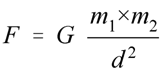
The gravity phenomena which discovered by Newton in 1686 then becomes the fundamental gravity method in geophysics
science. The method is uses in characteristic study of earth surface. The gravity method is based on spatial
observation of earth gravitational field variation due to rock density variation beneath the earth surface.
The Range Value Of Density Matters

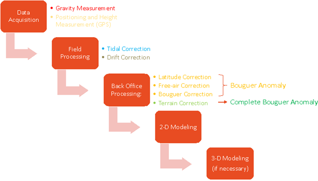
Gravity Method Flowchart
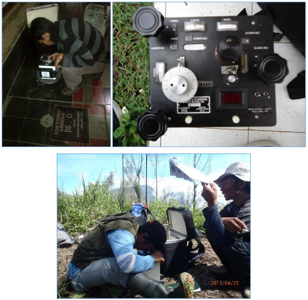
The gravity instrument should be calibrated in Bandung Calibration Lane (DG.0) – Tangkuban Perahu (GFVII)
before used in the survey area.
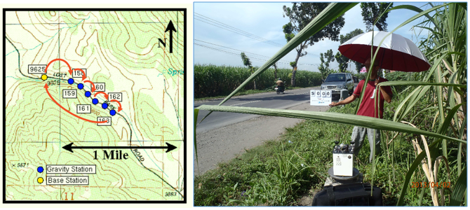 The relative gravitation device needs to measure absolute gravitation at one single point of gravitation network
(usually located by the side of main road) that use for a Base Station. The value of absolute gravity in Base Station
is measures daily for the first of survey, followed by the measurement of determined points in gravity survey lines.
The measurement of Base Station should be done at the end of survey.
The relative gravitation device needs to measure absolute gravitation at one single point of gravitation network
(usually located by the side of main road) that use for a Base Station. The value of absolute gravity in Base Station
is measures daily for the first of survey, followed by the measurement of determined points in gravity survey lines.
The measurement of Base Station should be done at the end of survey.
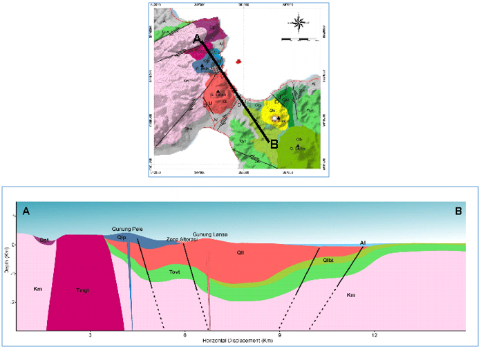 The Ground Magnetic method can be applied in geothermal prospecting. The subsurface model of geothermal area was generated from Residual Gravity Data.
It is used for identifies the subsurface structure and the location of heat source.
The Ground Magnetic method can be applied in geothermal prospecting. The subsurface model of geothermal area was generated from Residual Gravity Data.
It is used for identifies the subsurface structure and the location of heat source.