Metocean survey refers to the measurement and analysis of meteorological and oceanographic conditions in a specific area. This can include
collecting data on factors such as wind speed and direction, wave height and period, water temperature and salinity, and current velocity. The data collected
during a metocean survey is used to inform the design and operation of offshore structures such as oil rigs, wind turbines, and ports, as well as for navigation
and search and rescue operations.
Metocean studies are typically conducted by engineers with expertise in ocean and coastal engineering, Oceanography, meteorology, or a related field.
These engineers may have backgrounds advanced degrees in oceanography, meteorology, or a related field. Specifically, a metocean engineer is an engineer who
has specialized in the field of metocean, which is the study of the joint behavior of the atmosphere and the oceans. These engineers are responsible for the
design and operation of offshore structures such as oil rigs, wind turbines, and ports, as well as for navigation and search and rescue operations. They use
data from metocean surveys to inform the design of these structures and to assess the potential impacts of different weather conditions on their performance.
Additionally, engineers working in oceanography, meteorology, and coastal engineering also conduct metocean studies as part of their work. They may conduct
research, provide consulting services, or work in government or industry roles, and will use their knowledge of the ocean and weather patterns to make
predictions and recommendations related to offshore activities, coastal erosion, and other related issues.
There are several ways to conduct Metocean Survey:
1. Monitoring Wave Frequency and Current Velocity and direction using ADCP
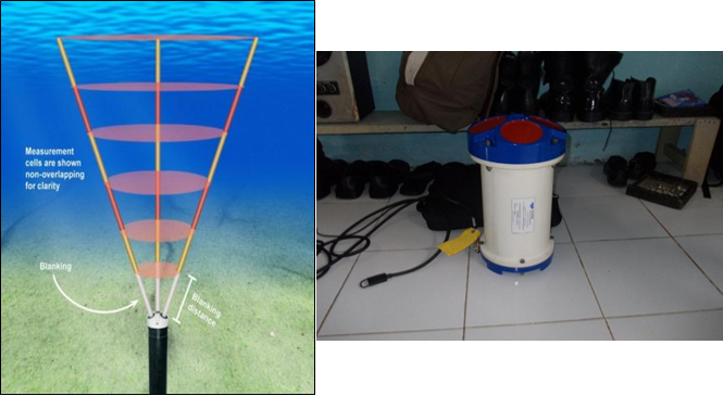
An Acoustic Doppler Current Profiler (ADCP) is a type of instrument that can be used to
measure velocity of water particles in a specific location. They emit a series of acoustic pulses,
which are reflected back by particles in the water. By measuring the frequency shift of current
and wave data in a metocean survey. ADCPs use the Doppler effect to measure the the reflected
signals, the instrument can determine the velocity of the particles and thus the speed and
direction of the current. An ADCP can be deployed in a variety of ways, depending on the
specific needs of the survey. It can be mounted on a buoy or anchored to the seafloor, or it can
be towed behind a boat or other vessel. The instrument can measure currents at multiple depths,
typically up to a few hundred meters, and can provide data on both the speed and direction of
the current.
ADCPs can also measure wave parameters such as wave height and period, by analyzing the
Doppler shift of the backscattered echoes from the wave surface. This is done by analyzing the
frequency shift of the echoes at different ranges, and using this information to determine the wave
height, and period. An ADCP is a powerful tool for measuring oceanographic data, and is widely
used in metocean surveys, coastal research, and offshore engineering projects.
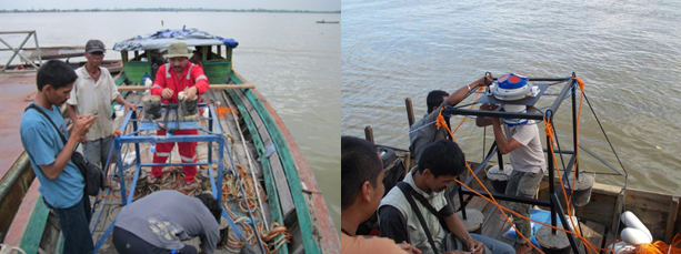
2. Monitoring Current Velocity and Direction by using Valeport Currentmeter
Valeport Currentmeters are instruments that can be used to measure current velocity and direction in a metocean survey. These devices work by measuring the speed and direction of
water particles in a specific location. They can be deployed in a variety of ways, depending on the specific needs of the survey. Current meter must be put in
certain depth once in place, the current meter will record the current velocity and direction at that location. The data can be recorded in real-time or stored for later analysis. Valeport
currentmeters are widely used in oceanographic research, coastal engineering, and offshore industry. They are known for their high accuracy and resolution, and can be used to measure
currents in a variety of different environments, including coastal waters, estuaries, and deep oceans.
3. Tidal Measurement. There are a variety of ways to survey tidal conditions, including:
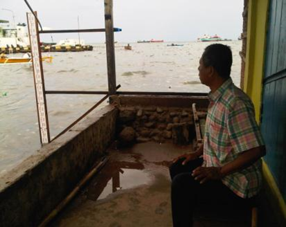
a. Tide gauges: Tide gauges are instruments that measure the height of the tide at a specific location. They can be mounted on a pier, on a buoy,
or on the seafloor, and typically use a pressure sensor or a float to measure the height of the water. Tide gauge data can be used to determine
the tidal range, or the difference between high and low tide, as well as the timing of high and low tide.
 b. in-situ measurements: Tidal condition can also be surveyed by in-situ measurements such as tide staff, and tide pole that can be placed on
the coast or shallow water area. The surveyor of the tidal will measure tide height every 1 hour for 15 or 30 days.
b. in-situ measurements: Tidal condition can also be surveyed by in-situ measurements such as tide staff, and tide pole that can be placed on
the coast or shallow water area. The surveyor of the tidal will measure tide height every 1 hour for 15 or 30 days.
 4. Meteorological Survey by using AWS
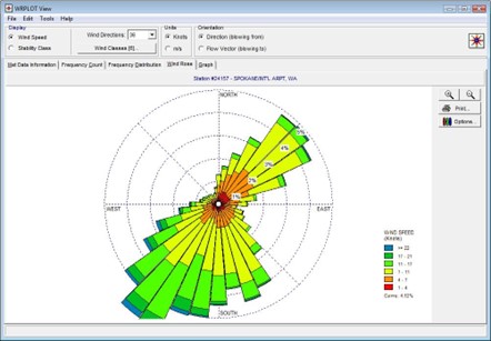
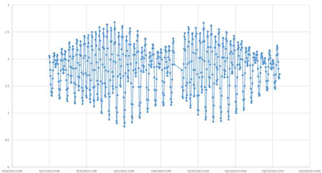
An Automatic Weather Station (AWS) is a type of instrument that can be used to survey metocean conditions. AWSs are typically used to collect
data on weather parameters such as temperature, wind speed and direction, precipitation, and atmospheric pressure. Some AWSs may also include
sensors to measure other metocean parameters such as relative humidity, solar radiation, and soil moisture.
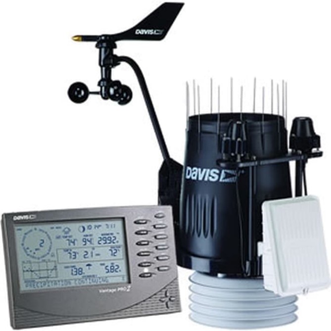 An AWS typically consists of a central control unit, which is connected to a variety of sensors. The control unit is responsible for collecting
data from the sensors and storing it in a memory. The data can be downloaded manually or automatically, depending on the design of the AWS.
An AWS typically consists of a central control unit, which is connected to a variety of sensors. The control unit is responsible for collecting
data from the sensors and storing it in a memory. The data can be downloaded manually or automatically, depending on the design of the AWS.
To survey metocean conditions using an AWS, the instrument would be installed in the location where the data is needed. The AWS would then be
calibrated, and the sensors would be configured to collect data at the desired intervals. Once the AWS is up and running, it will begin collecting
data on the weather and metocean conditions in the area.
AWSs can be used to survey metocean conditions over a period of time, which can be useful in understanding the long-term patterns of weather and
metocean conditions in a specific location. The data can be used to predict future weather conditions, as well as to understand the impact of
weather and metocean conditions on a variety of activities such as shipping, fishing, and coastal development.