One of the methods applied in subsurface exploration is the seismic method. The seismic method used in exploration is based on measuring the response of sound waves that propagate in a medium and are then reflected and refracted along differences in sediment layers or rock boundaries. Methods in seismic reflection measure the time of the incident wave from the reflecting layer of sediment or rock. While the method of seismic refraction is to determine the speed of seismic waves that propagate beneath the surface. This method is based on the nature of wave propagation which is refracted at a certain angle due to differences in wave velocity between modes.
The seismic reflection method is divided into two, namely shallow seismic and deep seismic. Shallow seismic has better resolution than deep seismic, but the depth of wave penetration is more limited. Shallow seismic can be applied to see the thickness of the sediment on the seafloor. The tool that uses this method and is commonly used for aquatic sediment exploration is the Sub Bottom Profiler (SBP). SBP works by emitting seismic waves or sound waves from explosions to the bottom of the water. The wave will penetrate the sediment layer. PT. PRIHADITAMA as the best and superior Geoscience Survey Consultant Expert Services company in Indonesia has carried out SBP Survey work around the Manyar Terminal of Gresik Port PT. Berlian Manyar Sejahtera from April 28 2021 to May 6 2021. The purpose of the SBP Survey work is to obtain underwater and subsurface images of the seabed using the principle of acoustic wave propagation. The additional purpose is to determine the distribution of geological information based on Soil Investigation drilled well data in the vicinity of the SBP Survey site.
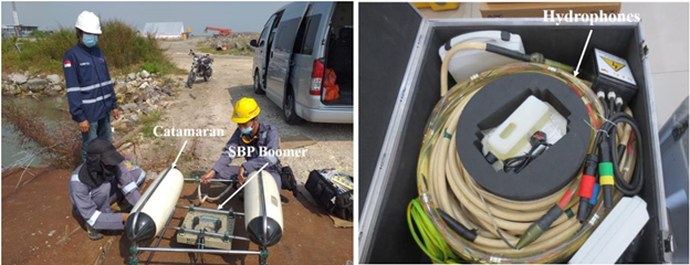
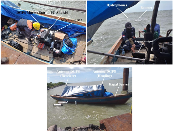
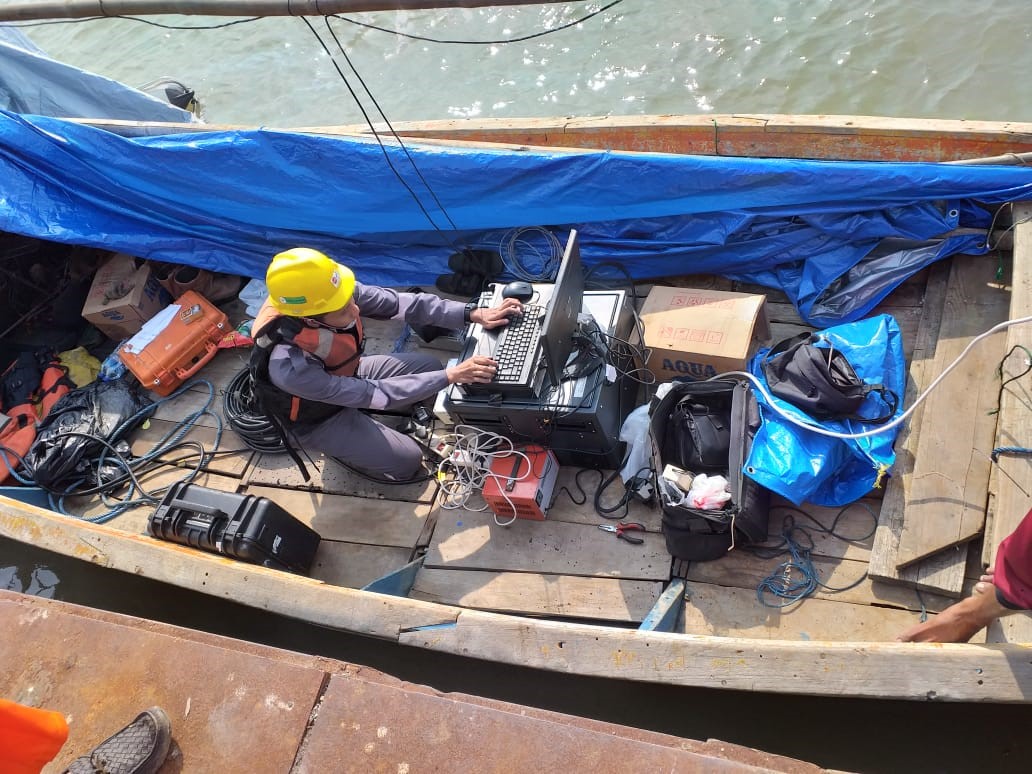
The nature of the propagation of acoustic waves in the medium can be used to describe the acoustic medium based on its physical properties. Acoustic medium in the world of geosciences can be in the form of air columns, water bodies, and subsurface rock layers that have acoustic impedance properties, namely the ability of rocks to pass acoustic waves through them. Physically, Acoustic Impedance is the product of multiplying the speed of an acoustic wave by the density of the medium. The harder a medium/rock, the greater the acoustic impedance, for example: very compact sandstones have a higher acoustic impedance than claystones. The Sub Bottom Profiler measurement method (basically has two main components, namely sound sources and hydrophones). At the time of data acquisition, the position of the Boomer type SBP device was placed by means of a towfish pulled by a survey vessel which was maintained in a position the ideal depth is around 1-3 meters above sea level so that a horizontal correction needs to be done because the position of the GPS antenna is different from the position of the towfish (offset).The distance between the transducer/hydrophones and the GPS antenna will be entered into the SBP data acquisition software, so that the final coordinates are indicates the position of the transducer/hydrophones used.
The data generated from the SBP is in the form of a profile of the distribution of layers of sea sand deposits laterally and a vertical profile in the form of the thickness of the rock layers below the surface of the seabed can reach a depth of 40 meters if using this type of instrument with impulse energy The SBP survey will not be carried out in choppy weather because it will greatly affect data quality. The possibility of noise originating from engines or survey ships must be minimized in various ways. The length of the seismic source and hydrophone cables shall be provided sufficient to allow them to be extended to a distance which will provide optimum data recording.