-
Basic Offshore Safety Induction & Emergency Training (BOSIET)
Jan 3, 2023 | Alditama Prihadi
Read more ...
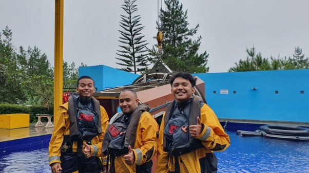
In January 2023, PT. PRIHADITAMA Geosciences Team: (1) Mr. Alditama Prihadi (President Director/ Oceanographer / Geophysicist), (2) Mr. Rizky Affianto (Geophysicist), and (3) Mr. Muh. Rama Adyaksa (Oceanographer) has completed their BOSIET certification training in Indonesia -

Oceanographic Model Experts
Jan 6, 2023 | Muh. Rama Adyaksa
Read more ...
Oceanographic models are a mathematical representation of the ocean, which include water column movement, ocean current, ocean waves, and chemical, physics, and biological conditions of the sea. Oceanographic models are used to understand and predict ocean behavior and that changes.
-

Geophysical Survey Design
Jan 20, 2023 | Faisal Perdana
Read more ...
The aim of geophysical method is to estimate a model or subsurface object based on observational data. Survey method in geophysical science consist of various kinds such as, geomagnetic survey, geoelectrical survey either 1D Geoelectrical survey or Vertical Electrical Sounding (VES) and also 2D geoelectrical survey or electrical resistivity tomography (ERT), gravity survey, georadar survey or ground penetrating radar (GPR), magneto telluric (MT) survey, and similar electro magnetic (EM) methods,
-

Internship in Bandung Prepares the Best Survey Experts
Jan 19, 2023 | Rizky Affianto
Read more ...
On January 15, 2023 we held internship program with held acquisition training, mapping, data processing, and reporting Goeradar/ GPR for Geofisika Student of UIN Jakarta. Internship program form PT. Prihaditama will open again for any students majoring in physics, Geophysics, Geodesy, oceanography who need internship or final assignment for their studies on campus, please contact us.
-

Groundmagnetic Survey Service Expert
Jan 6, 2023 | Faisal Perdana
Read more ...
PT. Prihaditama is a company of Ground magnetic Survey Service Experts who are experienced in conducting surveys for mineral mining exploration needs. The process of acquiring Ground Magnet data in a gold mining field in Gorontalo Province which was acquired by Mr. Sujana who is an experienced Magnet Surveyor in our company.
-

Bathymetry Survey Experts
Oct 27, 2022 | Alditama Prihadi
Read more ...
Bathymetry survey experts is someone who has expertise and experience in conducting bathymetry surveys. Bathymetry surveys is the process of measurement and mapping the depth of sea, which is used in the fields of nautical, oceanography, and management of marine resources.
-

Underground Mapping Survey Services
Sep 14, 2022 | Ferry Aries
Read more ...
An image similar with lawn mower below is a georadar tool with the brand MALA El Core 450Mhz. This tool can be used for underground mapping survey services such as cables, pipes, culverts, ducting, and archaeology objects.