Ground magnetic surveys can be a helpful tool for exploring gold deposits. Gold deposits often have associated minerals such as pyrite, which can be detected by their magnetic properties.
The study of geomagnetism is one of the oldest geophysical sciences. The geomagnetic field has been observed and used since ancient times. The use of geomagnetic data in the modern era includes navigation, regional
geological structure mapping, geothermal exploration, and mineral exploration.
Magnetic surveys measure variations in the Earth's magnetic field caused by different magnetic properties of rocks in the subsurface. In areas where gold deposits are expected, the survey can help identify areas with
magnetic anomalies that may indicate the presence of gold-bearing minerals.
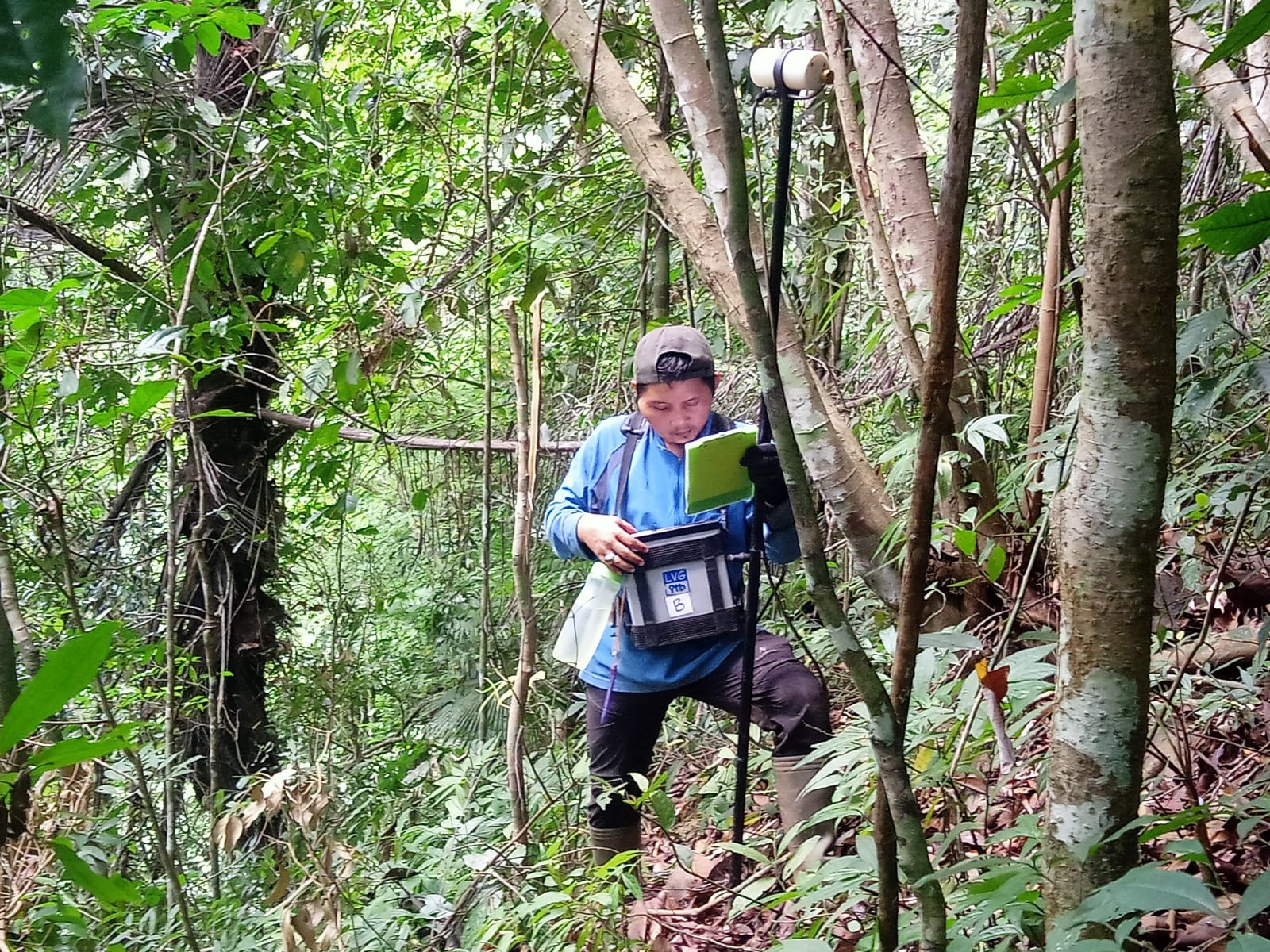
Magnetic surveys can be conducted using proton precession magnetometers. The magnetic survey is carried out using a minimum of 2 units of proton precession magnetometer. The first unit is used to observe the magnetic
field at one fixed point continuously during the survey carried out per day. Another unit was brought in by the operator to observe the magnetic field at points in the planned survey area. Observation of the magnetic
field in the survey area can be done with more than one magnetometer unit (especially for large areas so surveys can be carried out more quickly).
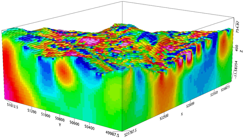
The proper processing and modeling can give subsurface imaging of the geological condition based on magnetic physical properties a.k.a. susceptibilities. It is the property of the rock of how strong the Earth's
magnetic field can magnetize it. The results of magnetic data processing are continued with 3-dimensional modeling as shown in the image below, where high susceptibility values are represented by magenta and low
values are blue. High magnetic bodies can be seen growing from the bottom up, you can tell more carried out by experienced geologists.
It is important to note that magnetic surveys alone cannot provide conclusive evidence of the presence of gold deposits. Other exploration techniques such as geochemical surveys, geological mapping, and drilling are
typically used in conjunction with magnetic surveys better to understand the potential for gold deposits in an area
The basic theories and basic concepts regarding magnetism can be seen further on the following pages.